I build smart Web GIS apps that make spatial data useful.

Helping people make better decisions with interactive, map-based solutions.

🌍 I’m available for remote freelance work worldwide — got a project in mind?
Let’s build it together.
Portfolio Hero Image

About

Crafting Interactive Web GIS Applications Passionate about turning spatial data into smart, user-friendly map platforms.

Profile Image
About Me

Web GIS Developer | Geospatial Specialist

I'm a Web GIS Developer with a strong background in geospatial technologies. Passionate about building smart, interactive mapping applications using open-source tools such as Python, Django, Leaflet, and PostGIS. I love turning spatial data into meaningful insights to support real-world decisions.

Name Keyhan Khosravifard
Age 30 Years
Occupation Freelance Web GIS Developer
Email keyhan.khosravifard@gmail.com

Technical Skills

Professional tools and technologies I work with

ArcGIS
Python
Django
PostgreSQL
Geoserver
JavaScript
HTML/CSS
Bootstrap
Git
Microsoft Office
AutoCAD Civil 3D
ENVI Software
Leaflet
Photoshop

Resume Overview

A comprehensive view of my academic background, achievements, publications, and work experience in GIS and spatial technologies.

🎓 Education

Master's

2019 – 2022

M.Sc. in Geomatic Engineering, Specialization in GIS

Graduate University of Advanced Technology, Kerman, Iran
  • Specialization: Web GIS applications and spatial analysis
  • Academic Background: Remote Sensing (RS), spatial databases, and basic machine learning
  • Thesis: Design and Implementation of a WebGIS-Based Recommendation System for Tourism Planning
  • GPA: 17.83 / 20

Bachelor's

2015 – 2019

B.Sc. in Geomatic Engineering (Surveying)

University of Sayyed Jamaleddin Asadabadi, Hamadan, Iran
  • Specialization: GIS and geospatial technologies
  • Thesis: Development of a Spatial Model for Sustainable Physical Development Using Fuzzy Logic
  • GPA: 17.82 / 20

🏅 Honors & Awards

2019

Graduated top of class – Bachelor’s in Geomatics Engineering

2022

Graduated top of class – Master’s in GIS Engineering

Work Experience

Specialized GIS and Web GIS development roles

GIS Specialist

Dec 2023 - Apr 2024

Confidential Company

Iran

  • Developed advanced GIS mapping solutions using ArcGIS
  • Designed spatial data visualization systems
  • Implemented custom geospatial analysis tools

WEB GIS Developer

2025 (Freelance)

Routing System Project

  • Developed GIS-based routing system using OpenStreetMap data
  • Imported shapefile road network into PostgreSQL/PostGIS
  • Implemented spatial queries for path calculation
  • Created interactive map visualizations with Folium
  • Tech Stack: Django, PostGIS, Folium, Python

WEB GIS Developer

Jun 2020 - Aug 2020 (Freelance)

Fault Monitoring System

  • Designed and implemented real-time fault monitoring system
  • Developed anomaly detection with visual alerts on interactive maps
  • Created automated warning system for dangerous faults
  • Tech Stack: Python, Django, Folium, JavaScript

Web GIS Instructor

2020 & 2025

Online Courses

  • Developed and taught curriculum for Web GIS technologies
  • Conducted interactive online training sessions
  • Mentored students in practical GIS application development

Portfolio

I design and develop Web GIS applications that transform spatial data into interactive, web-based solutions. Using technologies like Python, Django, Leaflet, and PostgreSQL, I’ve built systems for real-time monitoring, location-based recommendations, and geospatial data visualization tailored to both practical applications and research-driven goals.

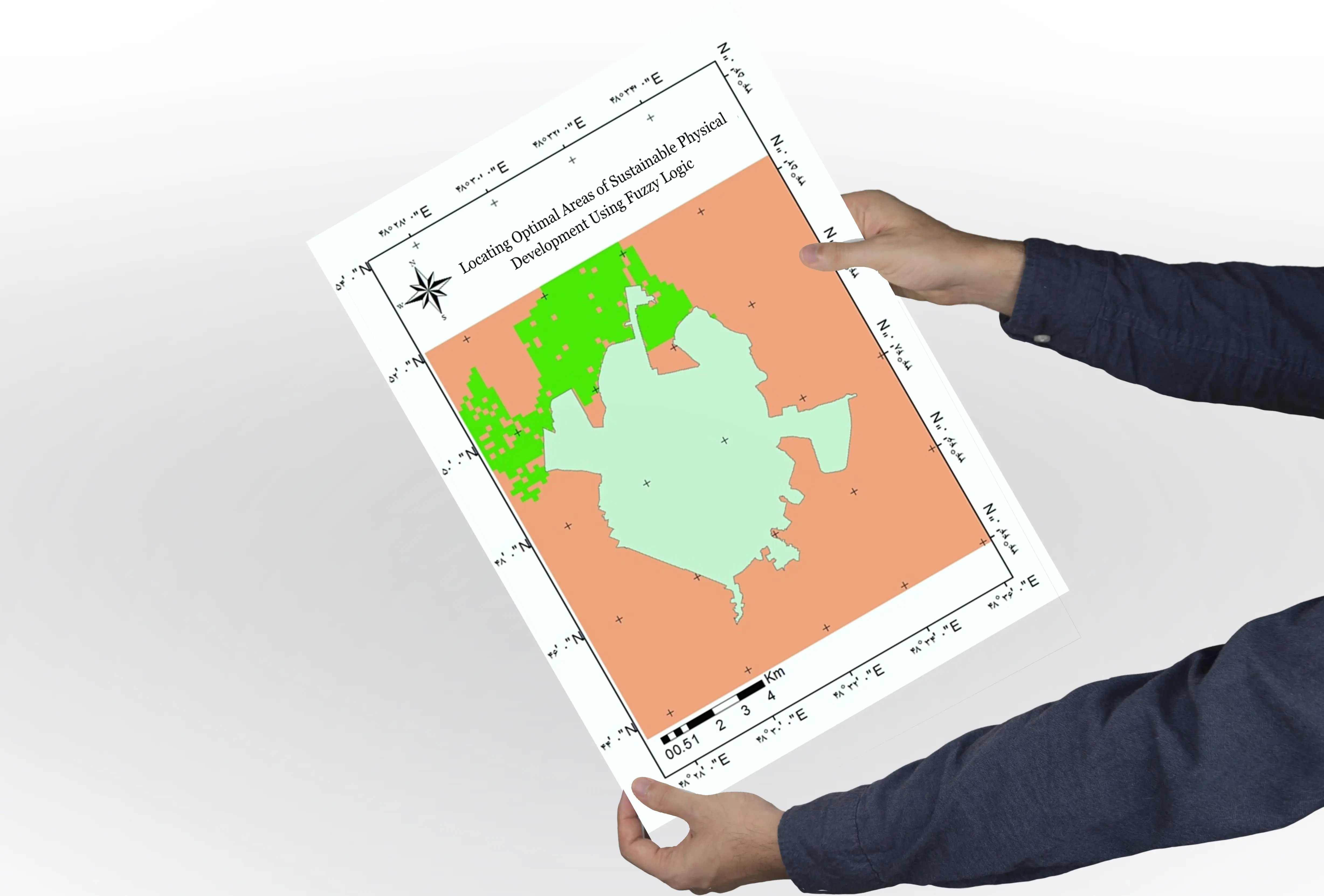
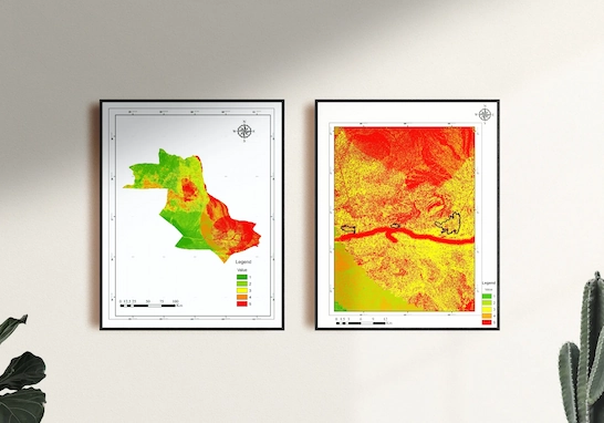
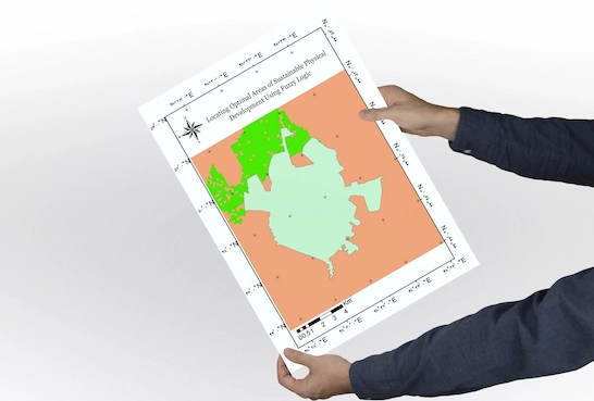
My background in classical GIS — including spatial analysis, remote sensing, and fuzzy logic — gives me the insight to develop Web GIS applications that solve real-world spatial challenges. My goal is to develop tools that are scalable, easy to use, and genuinely valuable for real users.

  • All Work
  • Web GIS
  • GIS Analyst
Web GIS

Urban Building Information System for Municipalities

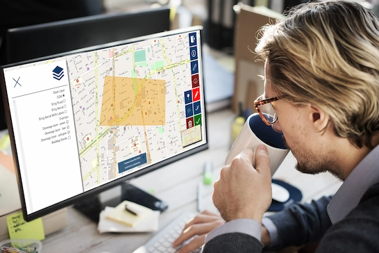
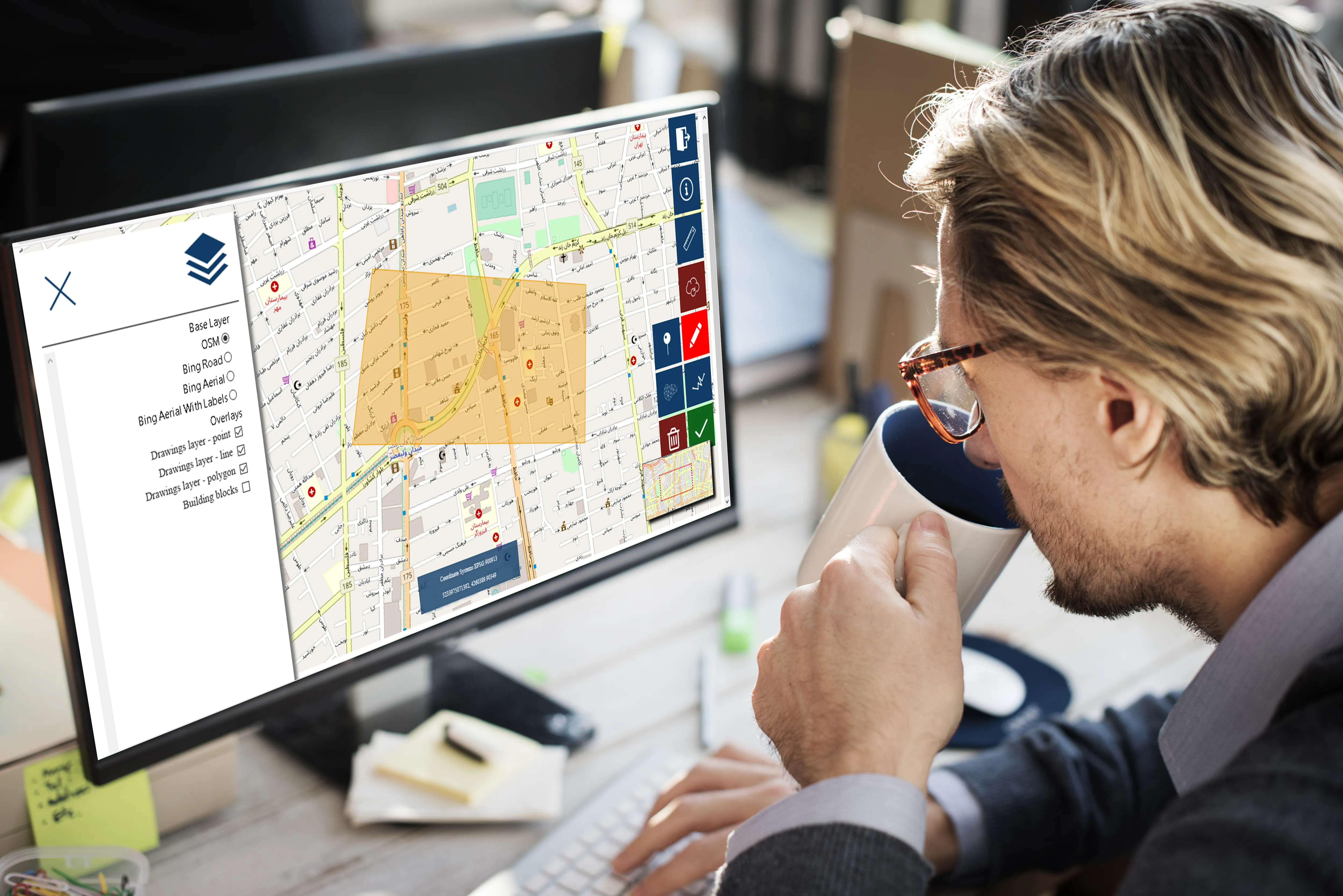
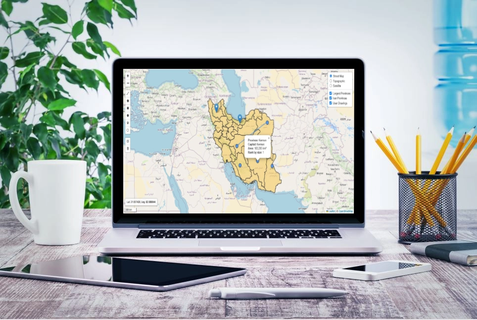
Developed a Web GIS system to allow users to access building block information through an interactive online map.

  • Enabled citizens to check property status and urban regulations anytime, without needing to visit the municipality.
  • Limited access to some data based on user roles.
  • Provided tools for drawing directly on the map and exporting the results.
  • Improved municipal efficiency and helped reduce in-person traffic.
  • Technical stack: Django, PostgreSQL/PostGIS, OpenLayers , JavaScript, HTML/CSS

Web GIS

GeoFault: Real-Time Web GIS for Fault Monitoring & Analysis

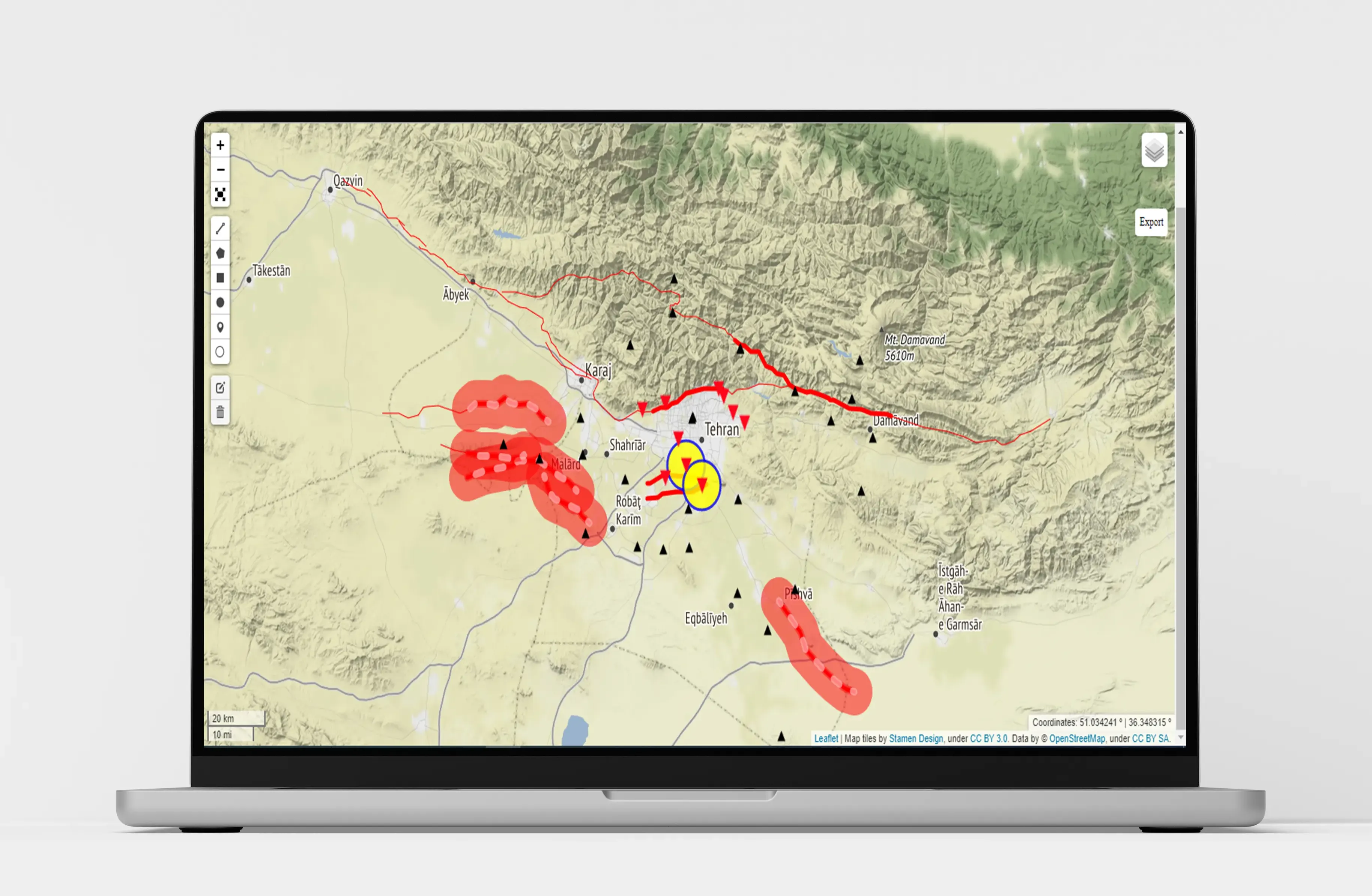
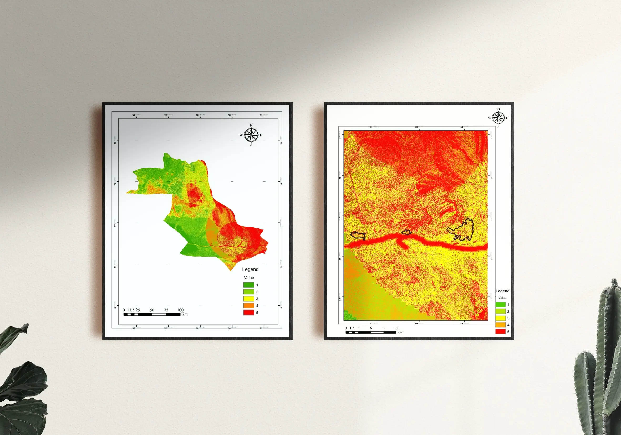
GeoFault is a Web GIS application developed as a freelance project for real-time monitoring and analysis of geological faults.
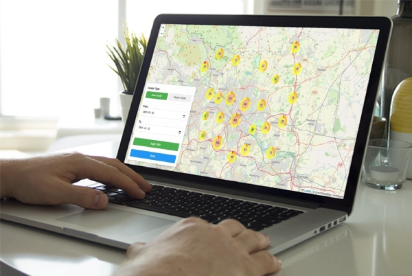
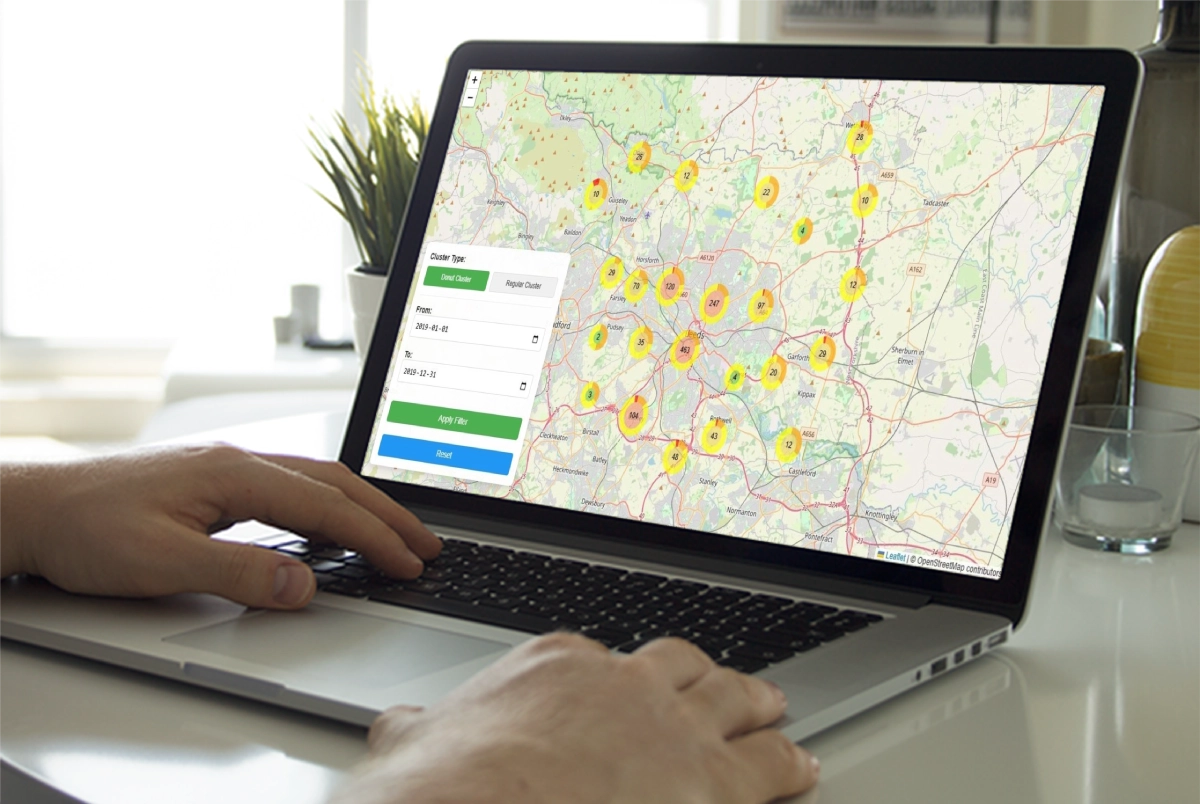
  • Interactive maps with fault anomaly visualization
  • Real-time alert system with color-coded warnings
  • Dynamic charts with time-based filters and adjustable parameters
  • Multi-layer map support: satellite, topographic, and custom layers
  • GIS drawing tools: points, lines, and polygons
  • Fully responsive design for desktop and mobile
  • Tech Stack: Django (Python), Folium, Bokeh

🎥 Watch Demo on YouTube

Web GIS

Context-Aware Recommender System for Tourism Planning (MSc Thesis)

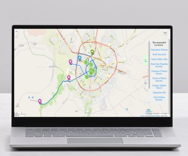
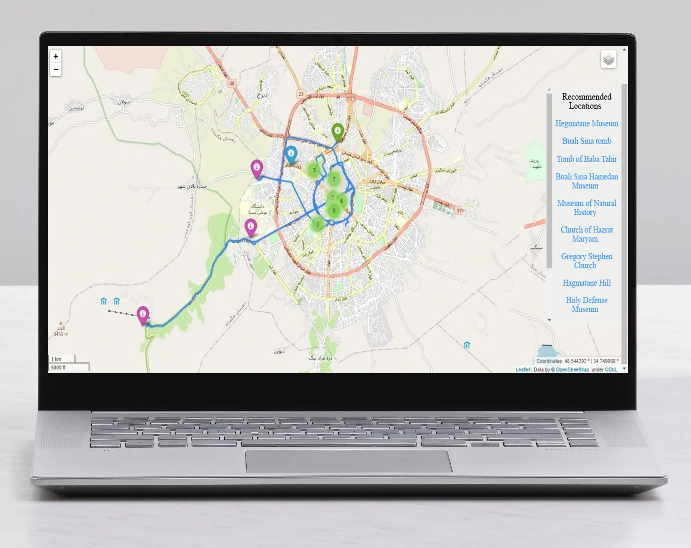
Designed and developed a context-aware recommender system based on Web GIS.

  • Recommended tourist attractions based on user preferences and contextual factors such as time, location, and weather conditions.
  • Used case-based reasoning to suggest attractions from ten interest categories (e.g., recreational, natural, historical, cultural).
  • Ranked and recommended the most relevant attractions and displayed the shortest route between them.
  • Displayed clustered locations of additional services—such as hotels, parking lots, and cinemas—on the map.
  • Tech Stack: Python, Django, PostgreSQL, Leaflet.js, JavaScript, HTML/CSS
Web GIS

Open-Source Web GIS Application (Basic Prototype)

Built a basic, extensible Web GIS demo for beginners, with full source code available on GitHub.

  • Visualized Iran’s provincial boundaries via WMS from GeoServer and overlaid major cities (by area) as GeoJSON point features.
  • Integrated multiple base maps (OpenStreetMap, topographic, satellite) with dynamic layer switching.
  • Enabled interactive map tools for drawing, editing, and visualizing spatial features with essential cartographic components for intuitive user interaction.
  • Tech Stack: Python, Django, GeoServer, Leaflet.js, JavaScript, HTML/CSS

🎥 Watch Demo on YouTube

Source code on GitHub: github.com/keyhangis

GIS Analyst

Flood Risk Mapping using Remote Sensing and a Combined GIS/Fuzzy AHP Model

  • Developed a flood susceptibility model using remote sensing data and a hybrid GIS, Fuzzy Logic, and AHP approach.
  • Selected key environmental parameters including rainfall, elevation, slope, distance from rivers, and vegetation cover
  • Ranked and recommended the most relevant attractions and displayed the shortest route between them.
  • Applied fuzzy membership functions and weighted overlay analysis in ArcGIS to generate the final flood hazard map.
  • Tech Stack: ArcGIS, Expert Choice, Remote Sensing, Fuzzy Logic, AHP
GIS Analyst

Locating Optimal Areas for Sustainable Urban Development Using GIS and Fuzzy Logic

  • Performed GIS-based spatial analysis to locate optimal areas for urban physical development.
  • Used fuzzy logic to evaluate and combine multiple spatial layers such as slope, fault proximity, and land characteristics.
  • Performed overlay analysis in ArcGIS to generate a suitability map for urban expansion.
  • Tech Stack: ArcGIS, Fuzzy Logic, Spatial Analysis, Urban Planning


Frequently Asked Questions

Here are some common questions clients ask before working with me. If you still have something on your mind, feel free to contact me directly!

What is Web GIS?

A Web GIS is a system that delivers GIS capabilities through the web. It helps users interact with maps and spatial data online.

What kind of projects do you work on?

I work on Web GIS projects like interactive maps and spatial web apps. I also do general GIS tasks such as spatial analysis and map creation using QGIS or ArcGIS. If it’s about GIS, I can help!

What technologies do you use?

I use tools like Leaflet, Django, PostgreSQL/PostGIS, JavaScript, and Python to build dynamic and scalable GIS web applications.

Do you work with international clients?

Yes! I work remotely and can collaborate with clients from anywhere in the world.

Can you help with small projects?

Yes, I’m available for both small and long-term freelance projects.

How do we start working together?

Just send me a message through the contact form or email me. We can discuss your needs and goals, and then I’ll share a proposal with you.

Let's Talk About Your Geospatial Project

Need WebGIS solutions or spatial data tools? I'd be happy to discuss how I can help with your project. I'm available for freelance work and new collaborations.